Product
TimelineResearchLab dataDocument namingDesktop assessmentGuideline screening3D mapping and volumesGroundwater trendsEnvironmental forensicsReports, tables and figuresSite FactsPortfolio prioritization
Solutions
Site owners & operatorsConsultantsEnvironmental lawyers Use cases Industries
Offerings
PlatformExpert servicesPortfolio programs
Resources
Case studiesGlossaryBlogEnviroBench
Trust Company Contact us

Visual Learner? Statvis Is Here for You

Explore environmental data visually

Data exploration needs to be easy. Most people are visual learners.

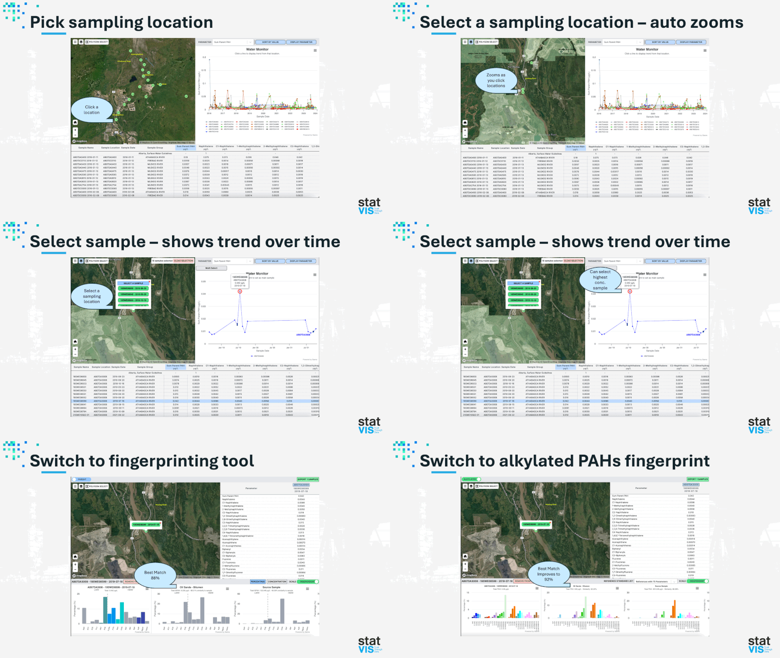
Statvis facilitates simultaneous geospatial, trend, and fingerprinting analysis. Here we demonstrate capabilities using PAH (polycyclic aromatic hydrocarbon) water monitoring data from Alberta's oil sands region.

Users can zoom into locations, select samples, and examine chemical fingerprints through an intuitive interface—all with just a few clicks of the mouse.

What is your data telling you?
Take control of your contaminated sites.

Bring us one site's documents. We'll show you what's in them.